
“How did it get so late so soon?”-Dr. Seuss

March 2016
One of my favorite short, aesthetic and rewarding ski tours in Colorado is the Silver Couloir on Buffalo Mountain in Summit County. Last year, during a brief visit back to the area, Zach and I thought we could fit a quick Silver Couloir ski in before I had to catch a flight back to Reno/Tahoe from the Eagle airport later that afternoon. I’m always trying to squeeze some skiing into every free moment!
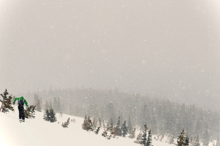
Starting at the trailhead in Silverthorne, Colorado we tried to make good time through the gently falling snow up into the clouds. The total tour is around 3,000 vertical feet, approximately 5.5-6 miles round-trip and about 2.5 of those miles are touring back around the base of the mountain at the bottom of the couloir. Others prefer to tour to the base of the couloir and boot pack directly up it, getting a better sense of the nature of the snow pack and general condition of the couloir prior to strapping skis on feet.

The Silver Couloir is striking even from a distance; a Y-shaped scar running 3,000 feet down Buffalo Mountain’s north-east flank. It’s notably visible while driving west on I-70 descending from the Eisenhower Tunnel towards the town of Silverthorne. Silver Couloir is well-known for making the list in Chris Davenport’s Fifty Classic Ski Descents of North America (check out his impressive photo and great write-up.) It is a beautiful line stretching 3,000 vertical feet straight down fall-line, I get goose bumps just thinking of it now…


Buffalo Mountain is the prominent hulking peak that looms over the town of Silverthorne and readily visible from Frisco. Its summit is 12,749 feet and is part of the Gore Range of the mighty Rocky Mountains in Colorado. Despite the large volcano-like crater near the summit of Buffalo Mountain it was actually a product of glacial activity. The crater was formed by two distinct glacial cirques that scrape the mountain in a unique erosive pattern over thousands of years.


As you near the bottom of the couloir, around 9800′, pay attention for a trail indicated by a clearing on the right. Follow this trail around back towards the trailhead. This is where you can add some distance and unnecessary work to your day by following the trail / clearing and continuing too far in a northeast direction following the terrain. On the map below look for the blue arrow and turn right here heading back towards the trailhead, if your groups misses this turn, and more mellow ascent, you will find yourselves with a steep slope to your right that is not ideal for skinning. (Somehow I have managed to still miss this turn most times I’ve done this route.) See below:

Well, adding some distance at the bottom of the chute is exactly what Zach and I inadvertently did. Despite knowing when and where to cut right to make it to the trailhead, we missed the turn and were moving rather frantically as my flight time was approaching.
Remember, I was trying to squeeze this last ski tour in while in Colorado before the flight back home and now things were not looking so good. The temps were warming but precipitation still falling; I was moving faster and faster trying to get back to the Eagle airport. “Zach, follow my tracks, I’m going to push ahead and get us back on track.” The snow was falling and it was so warm it was feeling more like rain at lower elevation.
Just as I crested the ridge my phone pinged and I saw that, my wife Lindsay was checking on our status. She had expected to hear from us earlier and I was now cutting my flight very close. “You’re going to miss your flight” she chided me. “I know! I’m doing the best I can, dear” as I looked left and right, I was now alone in the snow blanketed forest not entirely sure of my bearings.
Before long we made it to the trail and back to the car. As we hurriedly made our way back west, over Vail Pass and back out to Avon, we realized: there was no way I was getting on this plane on time. Just then my phone pinged once again. This time I breathed a sigh of relief; my flight was delayed until the morning due to weather. I was gonna make it home (without missing a flight) after all!

This was a close call, but I am always satisfied when we make the most out of our days in the mountains, and I am glad we packed this tour in as well.
Some the best pictures of the couloir are seen from nearby Ptarmigan Peak. We had an overcast day and relatively poor photo conditions for capturing the amazing views this great couloir can offer. Check out some of the links to trip reports below for a better idea and make sure to look at the Chris Davenports picture (with a write up from Lou Dawson) here.
Here are some old shots from another Silver Couloir ski with my buddy Travis back in 2013:


Links:
YouTube of skiing Silver Couloir with a bunch of Vail Hospital’s Anesthesiology Team
Silver Couloir, Buffalo Mountain, Summit Post Trip Report
14er’s.com Buffalo Mountain, Silver Couloir Trip Report
TGR Chris Davenport Interview on 50 Classic Ski Descents Book
Lou Dawson’s Wild Snow write up on Dav’s 50 Classic’s Book
Fifty Classic Ski Descents of North America Online
Chris Davenport 50 Classic Ski Descents of North America Facebook Page
Photo Credit Above:
All pictures of myself skiing Buffalo Couloir (including feature image) with photo credit to Zach Mahone Photography

Fantastic images of fresh turns, great stuff!
LikeLiked by 1 person